Charlotte, NC
The River District
Urban Life Within a Natural Setting
status
Ongoing
client
Crescent Communities
expertise
Master Planned Communities
services
Master Planning Landscape Architecture Civil Engineering Urban Design Land Planning

A Dynamic, Nature-Forward Community
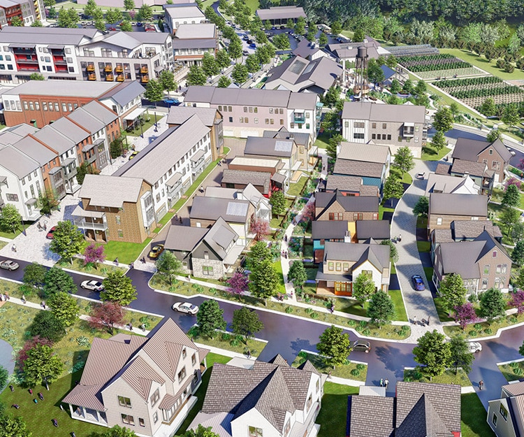
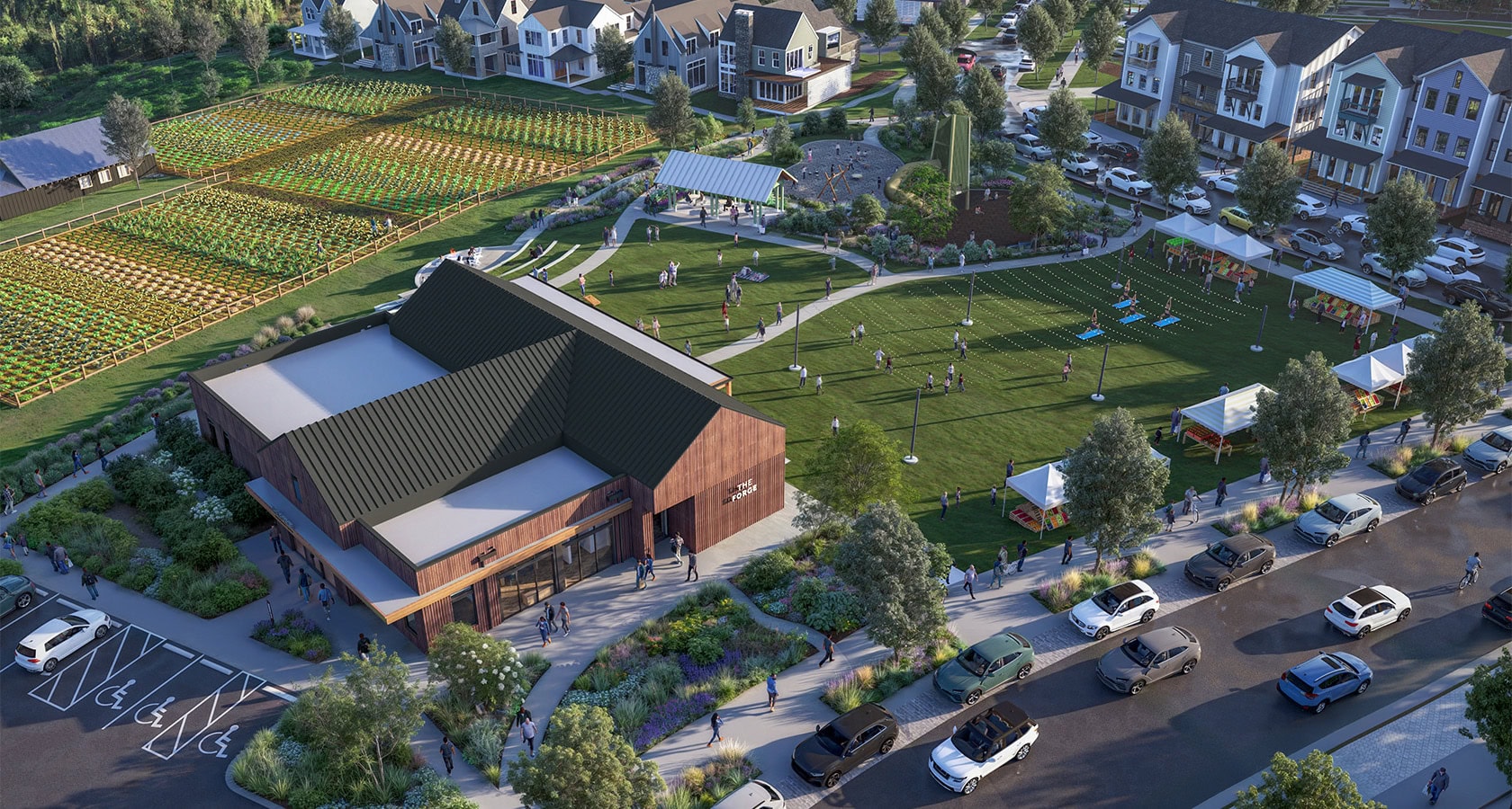
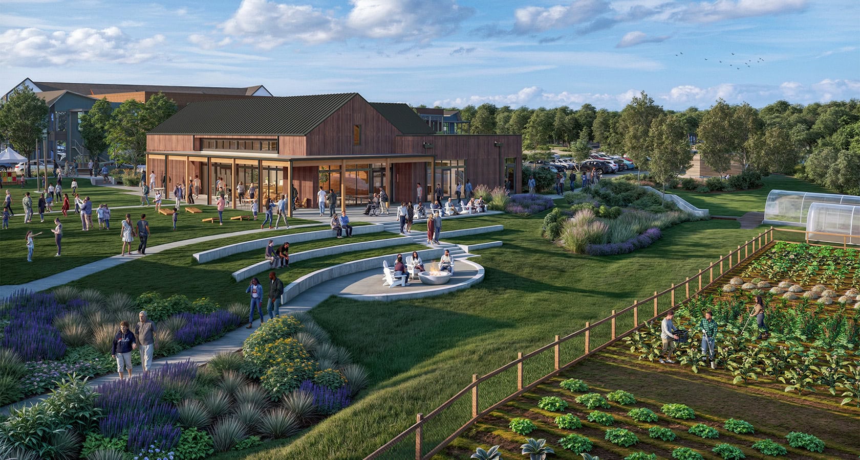
Defined by its relationship to the land and the connectivity of its uses, The River District combines natural splendor with urban convenience to create a vibrant mixed use community unlike anywhere else.
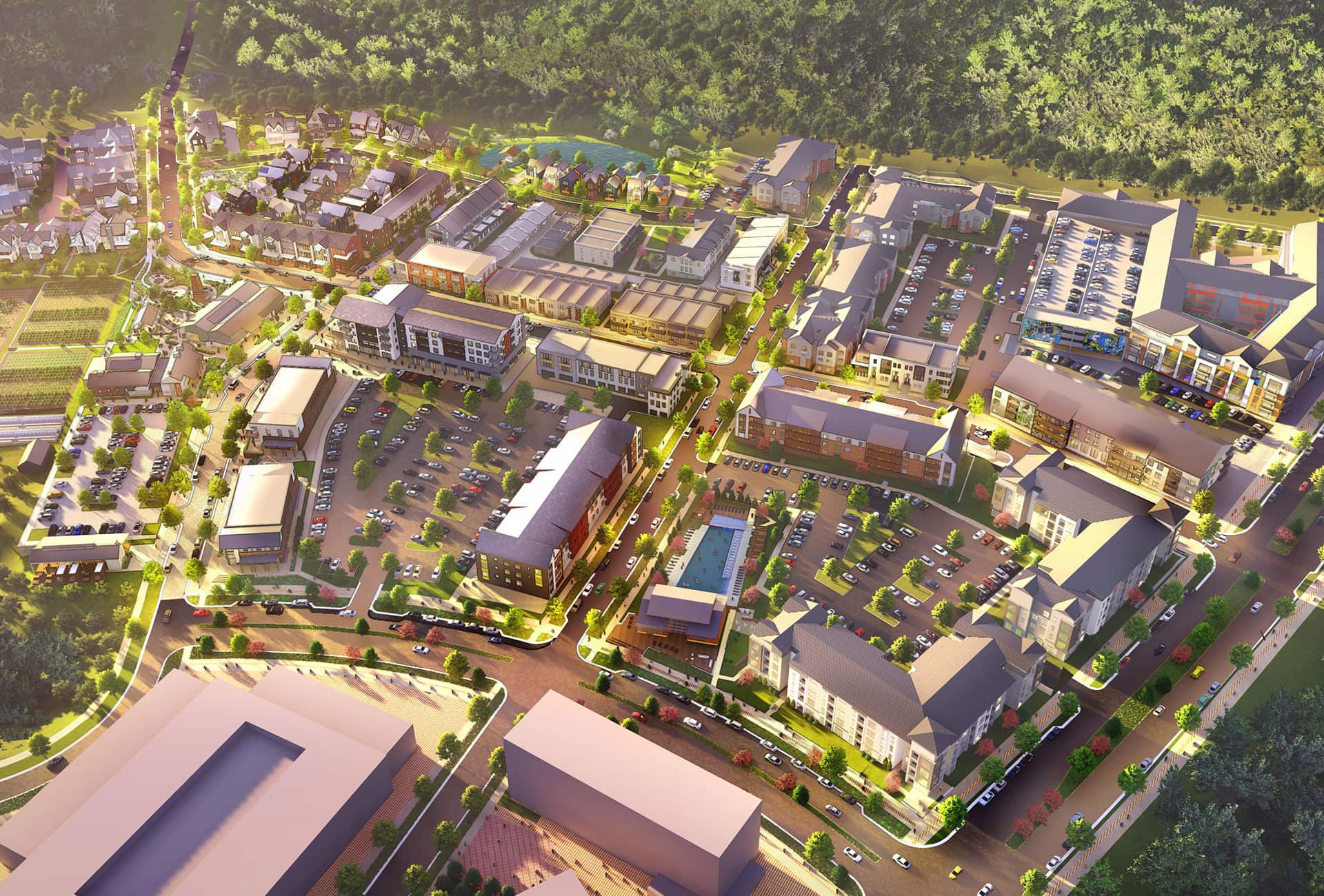
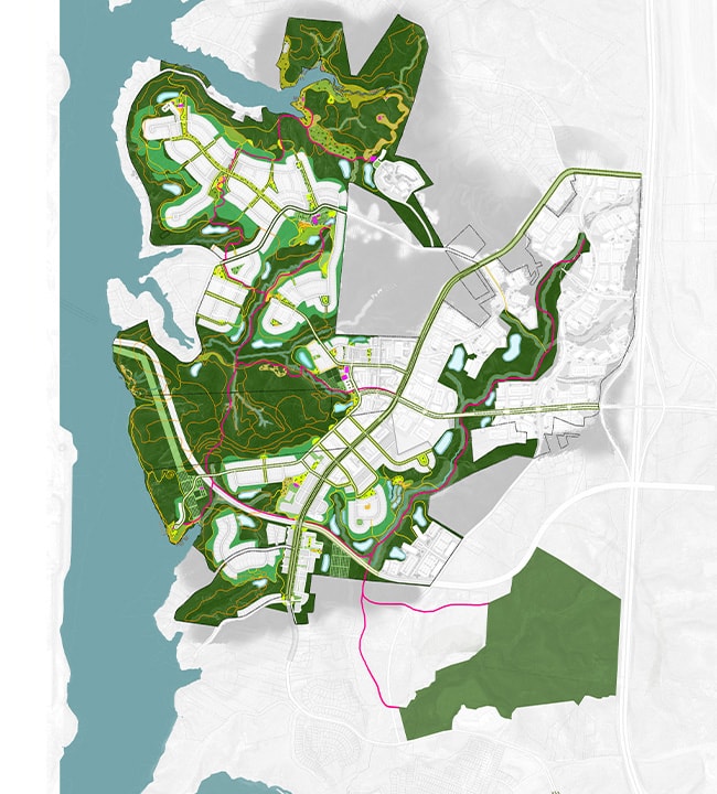
Located on the banks of the Catawba River and just west of the Charlotte Douglas International Airport, The River District is envisioned as Charlotte’s next great place to live, work, and play. With the property’s pristine natural surroundings as the centerpiece of the 1,400-acre community, The River District offers the energy and amenities of an urban lifestyle alongside an extraordinary connection to nature. Offering a full spectrum of residential and commercial opportunities surrounded by natural open spaces, The River District will foster unprecedented economic vitality for the region while providing a lasting environmental legacy.
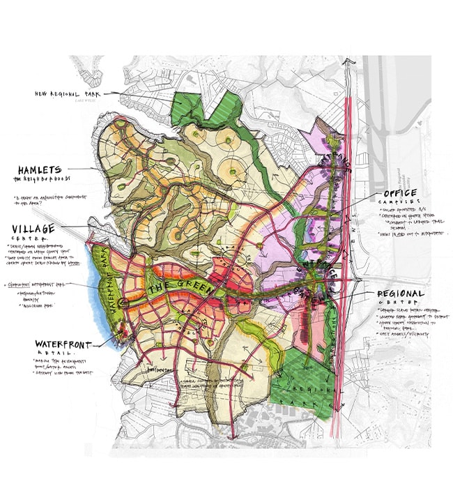
LandDesign is working with Crescent Communities to compose the master plan and design the infrastructure and public realm that will form the foundation of this community. Phased over a 20- to 30-year period, The River District will include approximately 8 million square feet of office space, 500,000 square feet of retail space, 1,000 hotel rooms, and 4,500 residential units. The project also allocates 75 acres of land for civic uses, including two new Charlotte-Mecklenburg County school sites, while preserving 550-acres of the site for greenways, parks, trails, and open space, including public waterfront access.
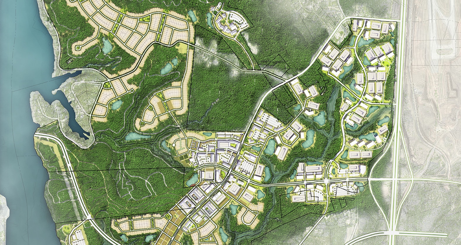
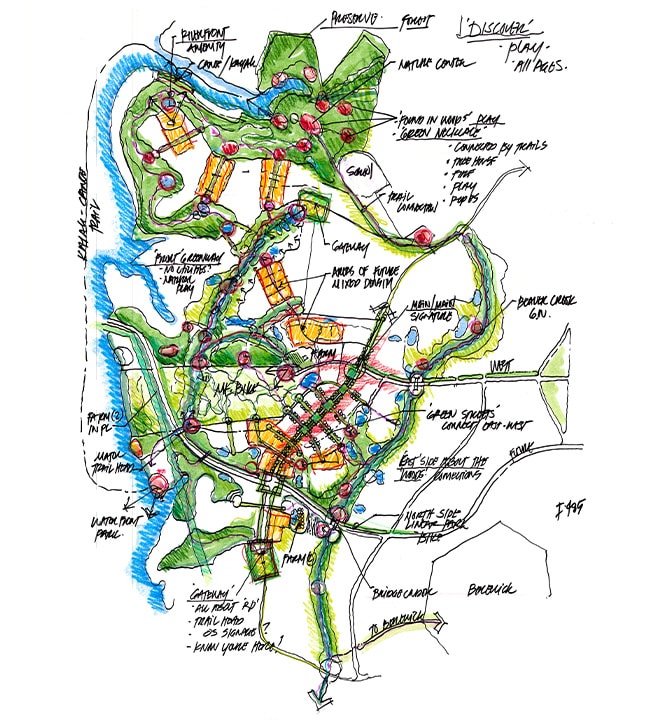
As a river-adjacent site, this property has extensive wetland and flood zone restrictions that limit developable area. The master plan protects and enhances the site’s existing ecosystems, water bodies, and parks by leveraging the undevelopable land as an opportunity to let open space guide the vision. Trails lie at the heart of the plans for The River District, providing recreational activities, increased mobility, and greater individual health.
Envisioned as the ideal blend of urban life and natural allure, The River District is designed to immerse the vibrancy and diversity of city living into a place that celebrates, protects, and provides direct access to the natural environment. To accomplish this, the design team took a small-scale approach to master planning – focusing on the daily lives of the residents and how people want to live. To create a concentration of people and activity, the design team applied fundamental urban design principles, mixing density, a diversity of uses, and public spaces within compact, pedestrian-scaled blocks.
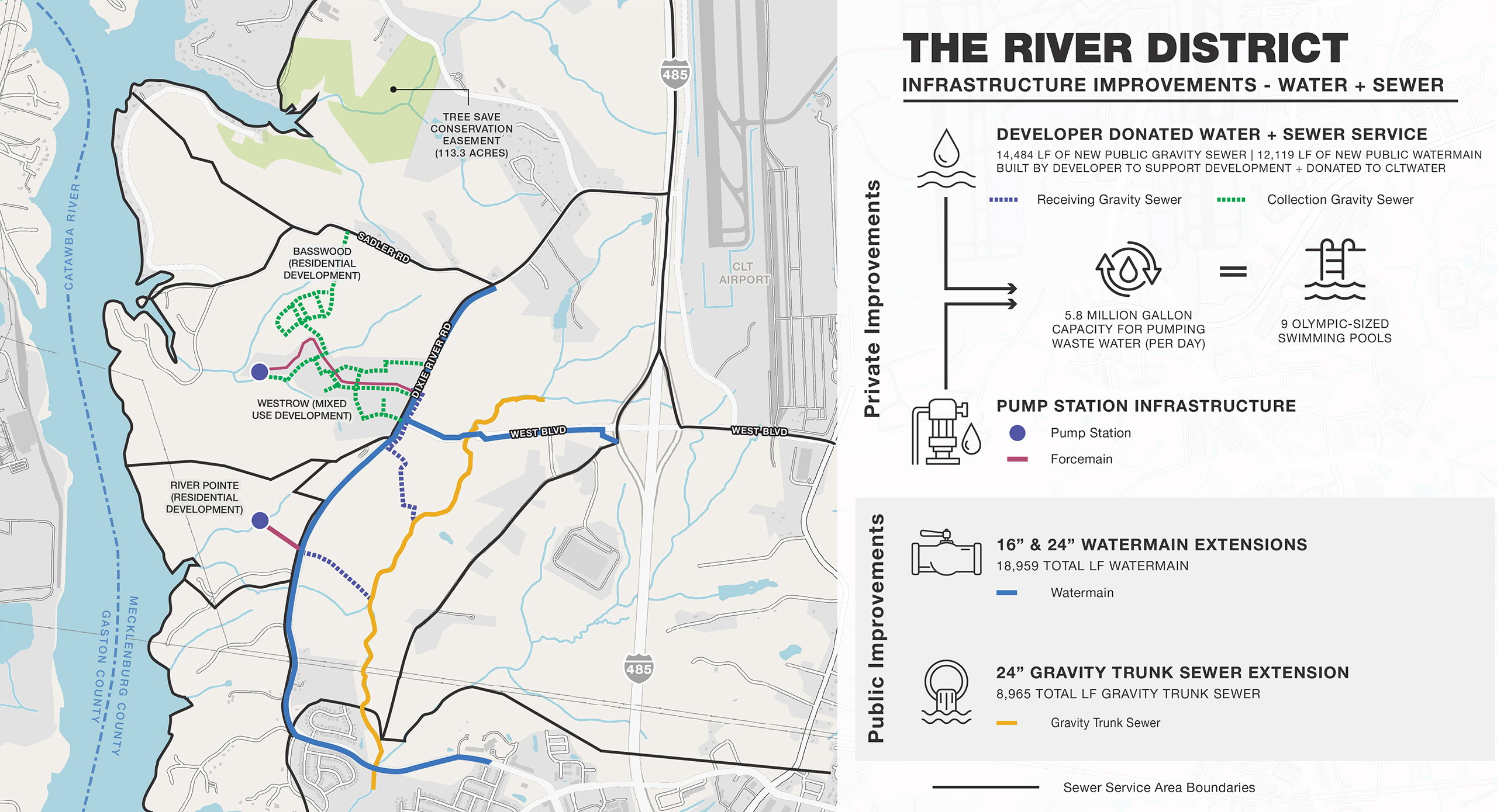
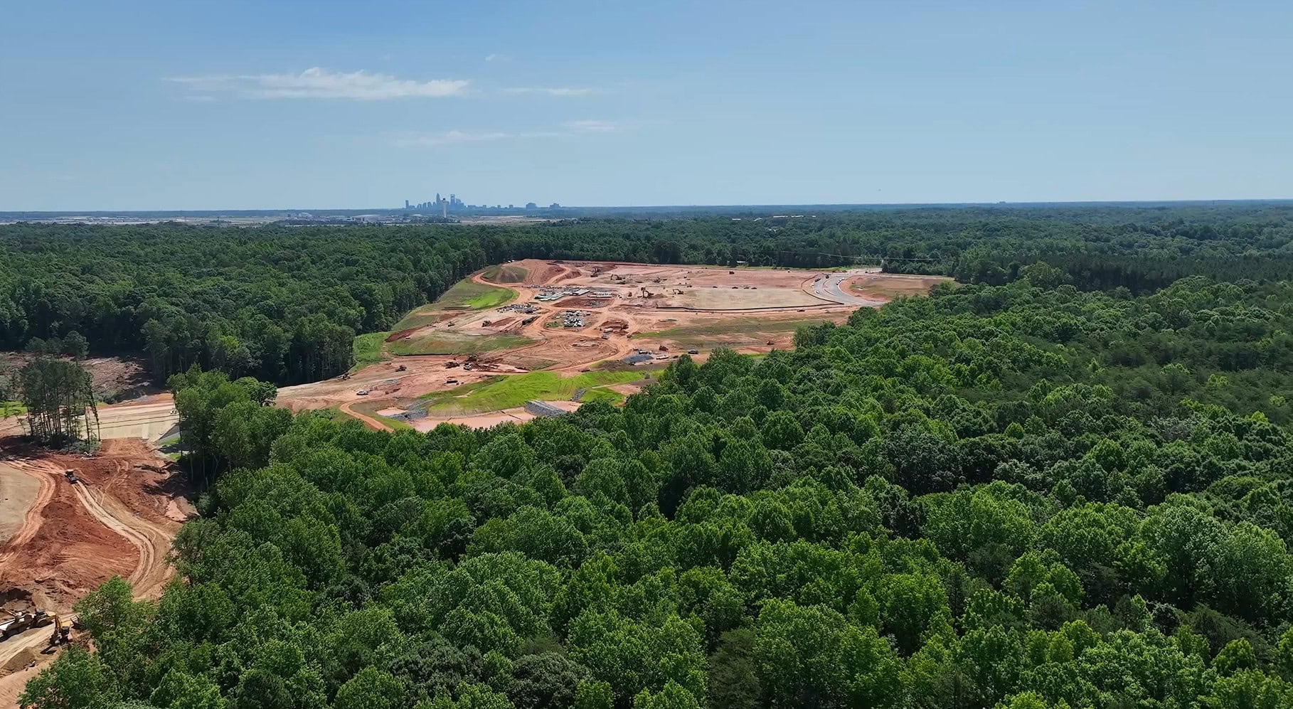
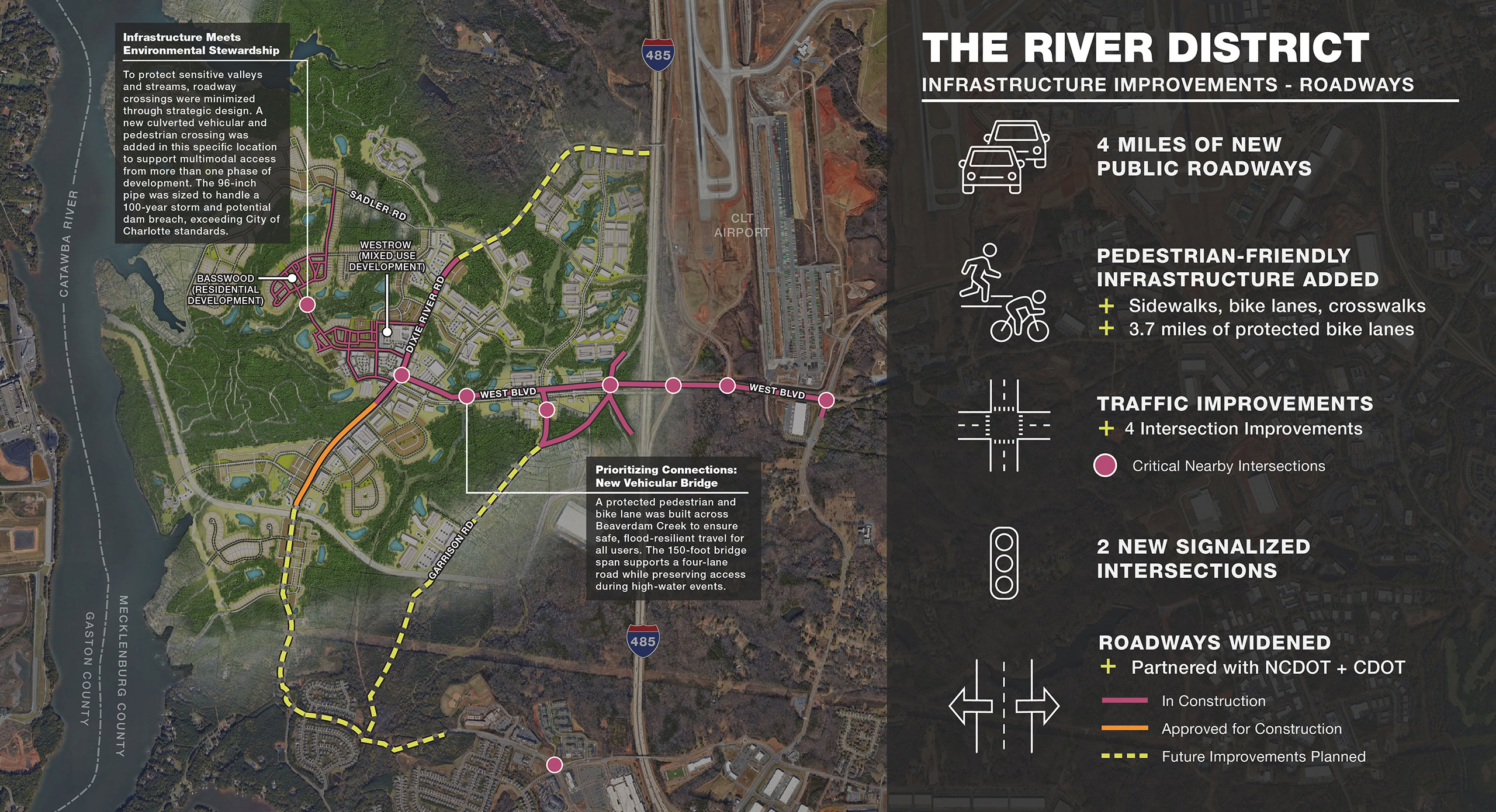
The project team is overcoming many challenges in land, history, and zoning on this heavily wooded greenfield site with no existing vehicular access or utility infrastructure. However, the isolated land and lack of infrastructure also granted additional flexibility in design, ensuring every element supports the envisioned lifestyle. With infrastructure planning running in parallel to land planning, LandDesign was able to ensure utilities and roads could be brought onto the site without compromising the client’s vision. The resulting master plan minimizes impact on the natural environment, with infrastructure designed to accommodate planned uses and open spaces.
On-Site at The River District
Access begins with infrastructure. Take a closer look at the design and engineering details behind the West Boulevard Extension that grants access to the first phase of The River District currently taking shape.
On-Site at The River District
Access begins with infrastructure. Take a closer look at the design and engineering details behind the West Boulevard Extension that grants access to the first phase of The River District currently taking shape.
Physical
Embrace natural resources, dramatic topography, preserved tree canopy, and open space as principle organizing elements
Functional
Provide a variety of close-knit, walkable neighborhoods that place residents near daily conveniences, offices, schools, arts and culture, and transportation
Social
Foster a community of lifelong discovery and growth with flexible community spaces and wellness-focused programming

Physical
Embrace natural resources, dramatic topography, preserved tree canopy, and open space as principle organizing elements

Functional
Provide a variety of close-knit, walkable neighborhoods that place residents near daily conveniences, offices, schools, arts and culture, and transportation

Social
Foster a community of lifelong discovery and growth with flexible community spaces and wellness-focused programming
-
50k
Permanent Jobs Generated
-
$2.7B
Tax Base Increase
-
$5.6B
New Annual Economic Output
Limiting Environmental Impact
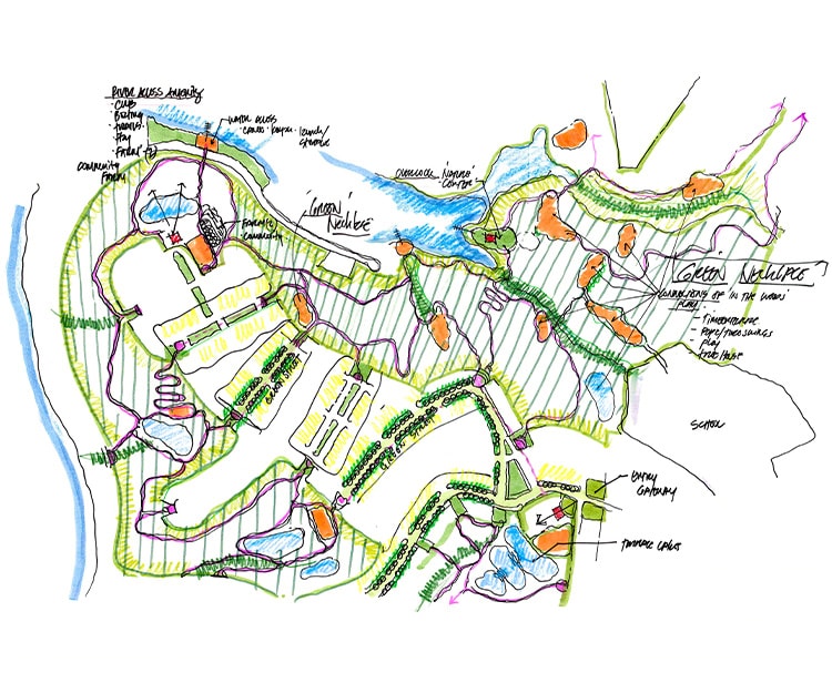
Dense and clustered development patterns allow 40% of the land to be preserved for open space, ensuring The River District achieves program requirements alongside lofty conservation goals.
Respecting the Environment
Using a sensitive approach to land planning, the design process began by identifying natural resource areas for preservation, such as steep topography, high quality tree canopy and stream corridors. To further minimize land disturbance, the client committed to an enhanced stream buffer–increasing the 50-foot requirement to 200 feet–as well as increased erosion control measures and stormwater management practices, setting a higher bar for water quality in the Catawba River Basin.
Progress Through Partnerships
Modern communities require a progressive, multi-disciplined, and long-term perspective to create lasting value. A project of this magnitude required the engagement of stakeholders well outside of the property limits. LandDesign’s longstanding relationship with the city and understanding of the local process enables us to identify these important stakeholders and bring them to the table early, including NCDOT, Charlotte Area Transit System, and Charlotte Douglas International Airport.
